
THEBUSINESSBYTES BUREAU
BHUBANESWAR, FEBRUARY 12, 2026
In a
significant reform aimed at safeguarding property transactions and
strengthening land governance, the Odisha government, in collaboration with the
Centre, is set to introduce QR code–enabled land pattas or Record of Rights
(RoR), Revenue Minister Suresh Pujari announced on Thursday.
The move
will make Odisha one of the frontrunners in leveraging digital technology to
curb land-related fraud and enhance transparency in the real estate ecosystem.
Under the new system, the RoR documents will carry a unique QR code that can be
scanned to instantly access comprehensive details about the land parcel.
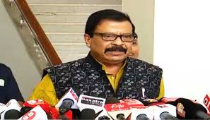
 Pujari said
the integration of QR codes into RoR documents would provide a secure,
tamper-proof and easily verifiable mechanism for land transactions. “By
scanning the QR code, complete land details will be available. This will
significantly reduce fraudulent practices in the buying and selling of land. In
case of any fraudulent transaction, the concerned Tehsildar and Revenue
Inspector will be immediately alerted,” he said.
Pujari said
the integration of QR codes into RoR documents would provide a secure,
tamper-proof and easily verifiable mechanism for land transactions. “By
scanning the QR code, complete land details will be available. This will
significantly reduce fraudulent practices in the buying and selling of land. In
case of any fraudulent transaction, the concerned Tehsildar and Revenue
Inspector will be immediately alerted,” he said.
Officials
indicated that the QR code–based verification system will allow buyers,
financial institutions and other stakeholders to authenticate land records in
real time, reducing dependency on manual verification and minimizing the scope
for manipulation of documents. The reform is expected to streamline property
registration processes and enhance investor confidence in Odisha’s land
administration framework.
The
initiative aligns with the broader push towards digital governance and
modernization of land records under central and state-level reforms. By
embedding digital authentication into key land documents, the government aims
to bring greater accountability and efficiency to revenue administration.
Beyond
digitization, the Revenue Minister also announced a comprehensive land survey
across the state. The exercise will assess the extent of government and private
land holdings, creating an updated and accurate land database.
Pujari further stated that a detailed repository will be prepared to document land allotted by various government departments over the years, along with information on its present usage. The database will help identify underutilized or misused land and support evidence-based policy decisions.
The twin initiatives — digital verification through QR-enabled pattas and a statewide land survey — are expected to strengthen land management, plug systemic loopholes and reinforce public trust in property transactions.